Crocknacreeva
| Crocknacreeva | |||
| County Antrim | |||
|---|---|---|---|
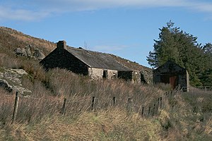
 Ruined cottage on the south slope of Crocknacreeva | |||
| Range: | Antrim Hills | ||
| Summit: | 1,132 feet D195297 | ||
Crocknacreeva is a hill amongst the Antrim Hills in the north-east of County Antrim, between Glendun to the north and Glenaan to the south.
The hill reaches 1,132 feet at its summit and is one of a piece with Gruig Top, which is 1,142 feet at its highest point.