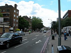
Stockwell
| Stockwell | |
| Surrey | |
|---|---|
 Stockwell Road | |
| Location | |
| Grid reference: | TQ305755 |
| Location: | 51°27’48"N, 0°7’13"W |
| Data | |
| Post town: | London |
| Postcode: | SW4, SW8, SW9 |
| Dialling code: | 020 |
| Local Government | |
| Council: | Lambeth |
| Parliamentary constituency: |
Vauxhall |
Stockwell is a town in Surrey now utterly contiguous with the London conurbation. Brixton, Clapham, Vauxhall and Kennington all border Stockwell. It was one of the poorest neighbourhoods of the metropolis, but it is now an up-and-coming area, owing to its close proximity to central London and good transport links. During the 1980s the first attempt at gentrification it was humorously nicknamed “St Ockwell”, but the current transformation of some small parts, is more recent.
The name of Stockwell probably got the second half of its name from a local well; the other half is from "stoc", which was Old English for a tree trunk or post.
History
From the thirteenth to the start of the nineteenth century, Stockwell was a rural manor at the edge of London. It included market gardens and John Tradescant's botanical garden – commemorated in Tradescant Road, which was built over it in 1880, and in a memorial outside St Stephen's church. In the nineteenth century it developed as an elegant middle class suburb. Residents included the artist Arthur Rackham, who was born in South Lambeth Road in 1867, moving with his family to Albert Square when he was 15.
Its social and architectural fortunes in the twentieth century were more mixed. The area immediately around Stockwell tube station was extensively rebuilt following the Second World War, and the original domed tube station was replaced first in the 1920s, then again with the opening of the Victoria line in 1971.
The area also has much social housing; the main estates are Lansdowne Green, Stockwell park, Studley, Spurgeon, Mursell and Stockwell Gardens. However, many remnants of the area's nineteenth century grandeur can be found in the side and back streets of Stockwell, notably in the Stockwell Park Conservation Area,[1] mostly built between 1825 and 1840 and centred on Stockwell Park Road[2], Stockwell Park Crescent,[3] Durand Gardens, and Albert Square. The only twentieth century building of significant architectural interest in the area is Stockwell Bus Garage.
In 1986 Kenneth Erskine, a serial killer dubbed the Stockwell Strangler, killed seven elderly victims, three of whom were from Stockwell.[4]
Churches
In addition to Anglican and Catholic churches, Afro-Caribbean communities have influenced the expression of Christianity in the area, with a variety of congregations, some sharing churches with more long established Anglican congregations. One of the many Afro-Caribbean churches is C.A.C. Stockwell.
Nearest stations
Tube
- Stockwell tube station
- Brixton tube station
- Clapham North tube station
- Vauxhall tube station
- Oval tube station
- Elephant and Castle tube station
Railway
- Brixton railway station
- Vauxhall station
- Wandsworth Road railway station
- Clapham High Street railway station
Outside links
- Stockwell News News, features and history relating to Stockwell