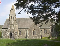
Underbarrow
| Underbarrow | |
| Westmorland | |
|---|---|
 All Saints Church | |
| Location | |
| Grid reference: | SD467921 |
| Location: | 54°19’19"N, 2°49’12"W |
| Data | |
| Population: | 330 (2011) |
| Post town: | Kendal |
| Postcode: | LA8 |
| Dialling code: | 01539 |
| Local Government | |
| Council: | Westmorland & Furness |
| Parliamentary constituency: |
Westmorland and Lonsdale |
Underbarrow is a small village in Westmorland, located three miles west of Kendal.[1]
The village is within the Lake District National Park.
Outside links
| ("Wikimedia Commons" has material about Underbarrow) |
References
- ↑ Descriptive Gazetteer Entry for Underbarrow – 'A Vision of Britain Through Time'
