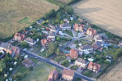
Barrows Green, Nottinghamshire
| Barrows Green | |
| Nottinghamshire | |
|---|---|
 A development at Barrows Hill | |
| Location | |
| Grid reference: | SK456520 |
| Location: | 53°3’50"N, 1°19’12"W |
| Data | |
| Local Government | |
Barrows Green is a hamlet in western Nottinghamshire, between Selston to the north-east and Jacksdale to the south-west.
Somercotes in Derbyshire is two miles to the west, across the River Erewash, which here forms the county border.