Hayton's Bent
| Hayton's Bent | |
| Shropshire | |
|---|---|
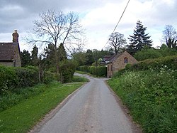
 Lane by Hayton's Bent | |
| Location | |
| Grid reference: | SO521807 |
| Location: | 52°25’22"N, 2°42’20"W |
| Data | |
| Post town: | Ludlow |
| Postcode: | SY8 |
| Local Government | |
| Council: | Shropshire |
Hayton's Bent is a hamlet in southern Shropshire. It is found three and a half miles north of Ludlow, on the rising slopes of the hills east of Corvedale, just off the local road from Ludlow up into the Clee Hills.
Below Hayton's Bent, to the west in the meadows beside the River Corve, are two smaller hamlets sharing its name; Upper Hayton and Lower Hayton.
Outside links
- Lower Hayton; Upper Hayton – BBC Domesday Reloaded