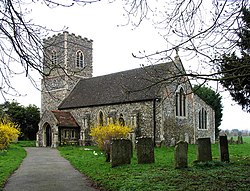
East Carleton
| East Carleton | |
| Norfolk | |
|---|---|
 St Mary, East Carleton | |
| Location | |
| Grid reference: | TG176020 |
| Location: | 52°34’23"N, 1°12’36"E |
| Data | |
| Population: | 343 |
| Post town: | Norwich |
| Postcode: | NR14 |
| Local Government | |
| Council: | South Norfolk |
East Carleton is a village in Norfolk, a few miles south of the swelling suburbs of Norwich. The nearest village of any size is Mulbarton, a mile to the south-east.
The parish had a population of 358 in 115 households at the 2011 census, the population falling to 343 at the 2011 census.
Outside links
| ("Wikimedia Commons" has material about East Carleton) |
