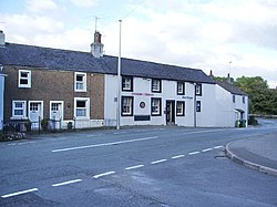
Bridgefoot, Cumberland
| Bridgefoot | |
| Cumberland | |
|---|---|
 The Dukes Head, Bridgefoot | |
| Location | |
| Grid reference: | NY057284 |
| Location: | 54°38’32"N, 3°27’42"W |
| Data | |
| Post town: | Workington |
| Postcode: | CA14 |
| Dialling code: | 01900 |
| Local Government | |
| Council: | Cumberland |
| Parliamentary constituency: |
Copeland |
Bridgefoot is a village in the very west of Cumberland. It stands at the meeting of the River Marron and Lostrigg Beck, approximately a mile south of the River Derwent. To the south it is seamlessly joined with the village of Little Clifton.
Outside links
| ("Wikimedia Commons" has material about Bridgefoot, Cumberland) |
