Beckces
| Beckces | |
| Cumberland | |
|---|---|
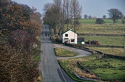
 Chapel House, Beckces | |
| Location | |
| Grid reference: | NY416277 |
| Location: | 54°38’28"N, 2°54’14"W |
| Data | |
| Post town: | Penrith |
| Postcode: | CA11 |
| Dialling code: | 017684 |
| Local Government | |
| Council: | Westmorland & Furness |
| Parliamentary constituency: |
Penrith and The Border |
Beckces is a hamlet in Cumberland, deep in land and at the edge of the Lake District fell country. It stands just north of the A66 Penrith to Keswick road, just 300 yards north of this main road.
The village is just with the northern boundary of the Lake District National Park (the bounds of which are drawn along the lane at the north of the village). Penruddock is less than a mile east of Beckces.
Outside links
| ("Wikimedia Commons" has material about Beckces) |

This Cumberland article is a stub: help to improve Wikishire by building it up.
