Armaside
| Armaside | |
| Cumberland | |
|---|---|
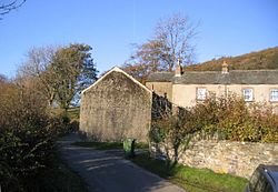
 Lane at Armaside | |
| Location | |
| Grid reference: | NY151275 |
| Location: | 54°38’10"N, 3°18’54"W |
| Data | |
| Post town: | Cockermouth |
| Postcode: | CA13 |
| Dialling code: | 019008 |
| Local Government | |
| Council: | Cumberland |
| Parliamentary constituency: |
Copeland |
Armaside is an agricultural village in Cumberland, standing to the north of Low Lorton, south-west of the River Cocker, and south east from Cockermouth.
The village consists of Armaside, Armaside Farm, Armaside Howe, and High Armaside. There is a local business dealing with wind turbines and other forms of renewable energy.
Outside links

This Cumberland article is a stub: help to improve Wikishire by building it up.