Henlade
| Henlade | |
| Somerset | |
|---|---|
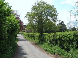
 Lane in Henlade | |
| Location | |
| Grid reference: | ST269235 |
| Location: | 51°0’23"N, 3°2’32"W |
| Data | |
| Postcode: | TA3 |
| Local Government | |
| Council: | Somerset West and Taunton |
| Parliamentary constituency: |
Taunton Deane |
Henlade is a hamlet in Somerset, between Ruishton to the north and Stoke St Mary to the south, to each of which it is joined by minor local roads. To the east is Thornfalcon. It lies within the Taunton Deane Hundred.
The hamlet is just over a mile from the M5 motorway, which separates these quiet villages from the swelling bulk of the county town, Taunton.
History
The tithings of Ruishton and Henlade formed part of the manor of Taunton Deane from the 9th century.[1]
Henlade House was built between 1805 and 1815, by an unidentified Italian architect for John Proctor Anderdon. It has been designated as a Grade II* listed building.[2] It is now a hotel named "Mount Somerset".
References
- ↑ Bush, Robin: 'Somerset: The Complete Guide' (Dovecote Press, 1994) page 175 ISBN 1-874336-26-1
- ↑ Images of England — details from listed building database (270895) Henlade House