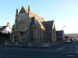
Pensarn
| Pensarn | |
| Denbighshire | |
|---|---|
 Pensarn Family Church | |
| Location | |
| Grid reference: | SH948785 |
| Location: | 53°17’35"N, 3°34’37"W |
| Data | |
| Post town: | Abergele |
| Postcode: | LL22 |
| Dialling code: | 01745 |
| Local Government | |
| Council: | Conwy |
| Parliamentary constituency: |
Clwyd West |
Pensarn is a suburb of Abergele in Denbighshire. It has a population of around 2,000.
The name Pensarn means 'end of the causeway' in English. The crossing of Morfa Rhuddlan was facilitated by a causeway near the sea, located at this point. This causeway was later flanked by the holiday developments along the coast.
Pensarn is served by Abergele and Pensarn railway station, the A55 road and National Cycle Route 5.
Outside links
| ("Wikimedia Commons" has material about Pensarn) |
This Denbighshire article is a stub: help to improve Wikishire by building it up.
