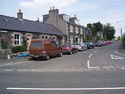
Killochyett
| Killochyett | |
| Midlothian | |
|---|---|
 Killochyett | |
| Location | |
| Grid reference: | NT457451 |
| Location: | 55°41’48"N, 2°51’55"W |
| Data | |
| Postcode: | TD1 |
| Local Government | |
| Council: | Scottish Borders |
Killochyett is a hamlet in Midlothian, adjoing the north end of Stow, on the east bank of the Gala Water, close to the Selkirkshire border. The Cookholm Burn separates the two villages before joining the Gala Water.
This Midlothian article is a stub: help to improve Wikishire by building it up.