Bowerhope
| Bowerhope | |
| Selkirkshire | |
|---|---|
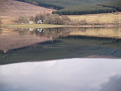
 Bowerhope, looking across St Mary's Loch | |
| Location | |
| Grid reference: | NT257227 |
| Location: | 55°29’33"N, 3°10’39"W |
| Data | |
| Post town: | Selkirk |
| Postcode: | TD7 |
| Local Government | |
| Council: | Scottish Borders |
| Parliamentary constituency: |
Berwickshire, Roxburgh and Selkirk |
Bowerhope is a tiny hamlet by the south shore of St Mary's Loch, in Selkirkshire. It is to be found village off the A708.
The hamlet’s name is from the Scots tongue, from the Old English bur hopa, meaning "farm valley"; it sits in a little bump in the shoreline of the loch, at the mouth of the Bowerhope Burn under the shadow of the hills each side, Bowerhope Law (1,568 feet) and Peat Law (1,742 feet).
Outside links
| ("Wikimedia Commons" has material about Bowerhope) |
