Tubney
From Wikishire
Revision as of 17:04, 19 October 2011 by RB (Talk | contribs) (Created page with '{{Infobox town |name=Tubney |county=Berkshire |picture=Cottages at Tubney - geograph.org.uk - 113771.jpg |picture caption=Cottages at Tubney |latitude=51.684482 |longitude=-1.372…')
| Tubney | |
| Berkshire | |
|---|---|
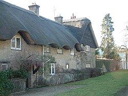
 Cottages at Tubney | |
| Location | |
| Grid reference: | SU436987 |
| Location: | 51°41’4"N, 1°22’20"W |
| Data | |
| Local Government | |
| Council: | Vale of White Horse |
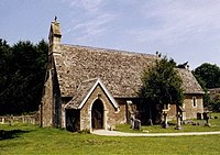
Tubney is a small village in Berkshire, lying eastward of Fifield and 4½ miles west of Abingdon, caught in the angle of the A420 Oxford to Swindon road and the A338 to Wantage.
The village gives its name to Tubney Wood to the north of the village, a part of the parish stretching to Appleton. Tubney wood and the Appleton Commons, which stretch from here to the Thames, are mixed woodlands. The south of the village is taken up with the vast sweep of Frilford Golf Course.
