Halford, Shropshire
| Halford | |
| Shropshire | |
|---|---|
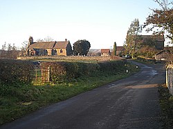
 The church at Halford | |
| Location | |
| Grid reference: | SO435833 |
| Location: | 52°26’42"N, 2°49’48"W |
| Data | |
| Post town: | Craven Arms |
| Postcode: | SY7 |
| Dialling code: | 01588 |
| Local Government | |
| Council: | Shropshire |
| Parliamentary constituency: |
Ludlow |
Halford is a hamlet in southern Shropshire. It lies just east of the small town of Craven Arms, and part of its civil parish, although on the other side of the River Onny. It forms a detached part of the ancient parish of Bromfield. Bromfield Priory held land at Halford, explaining the connection with its mother parish.[1]
References
| ("Wikimedia Commons" has material about Halford, Shropshire) |
- ↑ British history online Bromfield Priory

This Shropshire article is a stub: help to improve Wikishire by building it up.
