Chapelknowe
| Chapelknowe | |
| Dumfriesshire | |
|---|---|
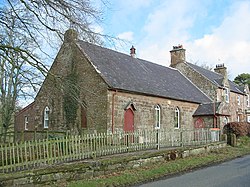
 Chapelknowe Public Hall | |
| Location | |
| Grid reference: | NY312734 |
| Location: | 55°3’1"N, 3°4’41"W |
| Data | |
| Postcode: | DG14 |
| Local Government | |
| Council: | Dumfries and Galloway |
Chapelknowe is a small village in Dumfriesshire, at a crossroads on the B6357, between Canonbie and Kirkpatrick-Fleming. Chapelknowe is just a mile from the River Sark, which marks the boundary with Cumberland.