Plym Valley

The Plym Valley is carved through southwestern Devon by the River Plym running off Dartmoor to the sea at Plymouth. The valley contains a variety of sights and habitats, from the ancient moorland remain in the upper valley to the industrialised and urban landscapes filling the valley as it approaches the sea.
Upper Plym Valley
- Location map: 50°28’44"N, 3°59’17"W
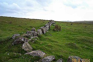
The Upper Plym Valley is on Dartmoor. This landscape is particularly noted for a large array of archaeological sites rnging from prehistoric Drizzlecombe to 19th century Eylesbarrow Mine.
In an area of six square miles of Dartmoor landscape, the Upper Plym Valley contains some three hundred Bronze Age and mediæval sites. The sites are in the care of English Heritage.
Lower Plym Valley
Below Dartmoor the Plym Valley broadens through the Devon farmland between the hills and the sea., with Bickleigh the last big village before the townscape begins to encroach. The river passes Plymbridge Woods, preserved by the National Trust.
The Plym Valley Railway operates in the lower valley, a heritage line reviving a mile and a half of a closed railway.
Soon the west side of the valley and then the whole valley are filled with the towns and suburbs surrounding Plymouth, amongst them Plymbridge and Plymstock, until the valley discharges its river into Plymouth Sound.
Outside links
- Upper Plym Valley - English Heritage