Ystradowen
| Ystradowen | |
| Glamorgan | |
|---|---|

| |
| Location | |
| Location: | 51°29’20"N, 3°25’23"W |
| Data | |
| Post town: | Cowbridge |
| Postcode: | CF71 |
| Dialling code: | 01446 |
| Local Government | |
| Council: | Vale of Glamorgan |
| Parliamentary constituency: |
Vale of Glamorgan |
Ystradowen is a small village and ancient parish in Glamorgan. It is located on teh A4222 road between Cowbridge, three miles to the south and Pontyclun, three miles to the north. The name Ystradowen means "Owen's Valley". The village was served by Ystradowen railway station between 1865 and 1951.
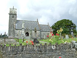
Local amenities include St Owen's parish church, The White Lion public house, Tudor Garage and Seven Oaks fisheries.
Outside links


This Glamorgan article is a stub: help to improve Wikishire by building it up.