South Charlton
| South Charlton | |
| Northumberland | |
|---|---|
 St James, South Charlton | |
| Location | |
| Grid reference: | NU164202 |
| Location: | 55°28’25"N, 1°44’33"W |
| Data | |
| Local Government | |
| Council: | Northumberland |
South Charlton is a small village in Northumberland, five miles northwest of Alnwick and close to Eglingham, in whose civil parish it falls, if not its chuch parish.
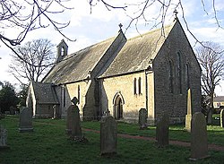
The parish church of St James, South Charlton was built in 1862 by James Deason of London for the 4th Duke of Northumberland, in an Early English style. It is a Grade II listed building.[1]
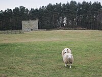
Heiferlaw Tower stands two miles south-east of the village, on the slopes of Heifer Law. It is a ruined fifteenth century pele tower built by the monks of Alnwick Abbey.[2] , a ruined fifteenth century pele tower built by the monks of Alnwick Abbey.[3]
 |
Outside linksReferences |