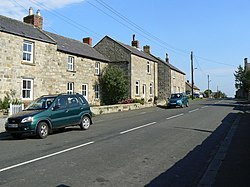
Glanton
| Glanton | |
| Northumberland | |
|---|---|
 Glanton | |
| Location | |
| Grid reference: | NU075145 |
| Location: | 55°25’26"N, 1°52’59"W |
| Data | |
| Population: | 239 (2011) |
| Post town: | Alnwick |
| Postcode: | NE66 |
| Dialling code: | 01665 |
| Local Government | |
| Council: | Alnwick |
| Parliamentary constituency: |
Berwick-upon-Tweed |
Glanton is a small, rural village in Northumberland. Historically, Glanton was a relatively industrial village, but in recent years the level of industry has declined and agriculture has reasserted its dominant role in the village economy.
About te village
The Devil's Causeway passes the eastern edge of the village. The causeway is a Roman road which starts at Port Gate on Hadrian's Wall, north of Corbridge, and north of that frontier for fifty-five miles across Northumberland to the mouth of the River Tweed at Berwick-upon-Tweed.
Outside links
| ("Wikimedia Commons" has material about Glanton) |
