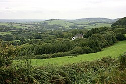
Penn, Dorset
| Penn | |
| Dorset | |
|---|---|
 Smith's Farm Cottages, Penn | |
| Location | |
| Grid reference: | SY333955 |
| Location: | 50°45’21"N, 2°56’48"W |
| Data | |
| Postcode: | DT7 |
| Local Government | |
Penn is a small hamlet in Dorset, in the very west of the county, hard by the Devon border, which is here marked by the main road (now the A39) and the River Lim, which runs down to the coast at Lyme Regis just two miles to the south. It is in the parish of Wootton Fitzpaine, a village just to the east.
The Monarch's Way long distance footpath runs through Penn, on its last miles to Lyme.