Cowie
| Cowie Gaelic: Collaidh | |
| Stirlingshire | |
|---|---|
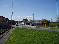
 The main road through Cowie | |
| Location | |
| Grid reference: | NS838890 |
| Location: | 56°4’50"N, 3°52’1"W |
| Data | |
| Dialling code: | 01786 |
| Local Government | |
| Council: | Stirling |
| Parliamentary constituency: |
Stirling |
Cowie is a village in the parish of St Ninians in Stirlingshire. It lies on the minor B9124 road approximately four miles south-east of the county town, Stirling and about a mile north of the main A9 road. The United Kingdom Census 2001 recorded the population as 2,387.[1] Its name is from the Scottish Gaelic Collaidh, meaning wooded place.
Cowie was formerly a pit village and stone quarrying was carried on in the surrounds. It is now the site of a factory manufacturing engineered wood products and other light industries. Recent years have seen significant new housing developments in the village for commuters.
Notes
Outside links
| ("Wikimedia Commons" has material about Cowie) |
This Stirlingshire article is a stub: help to improve Wikishire by building it up.
