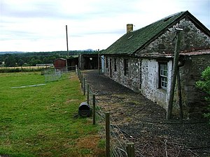
Cargill

Cargill is a parish in eastern Perthshire situated 7½ miles north-east of the county town, Perth. It contains the villages of Burrelton, Wolfhill, and Woodside and extends from the River Tay to the Angus border. The name, of Celtic origin, signifies a village with a church. This place originally formed a portion of the parish of Coupar Angus, from which, according to ancient records, it was separated prior to the year 1514.
The A93 road from Perth to Blairgowrie passes through the parish in a north-easterly direction.
Outside links
- Location map: 56°30’54"N, 3°22’48"W
This Perthshire article is a stub: help to improve Wikishire by building it up.