Rattray
| Rattray | |
| Perthshire | |
|---|---|
 Rattray and the river | |
| Location | |
| Grid reference: | NO187456 |
| Location: | 56°35’36"N, 3°19’54"W |
| Data | |
| Postcode: | PH10 |
| Local Government | |
| Council: | Perth and Kinross |
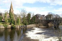
Rattray is a town and parish in Perthshire, along the River Ericht, across the river from Blairgowrie, with which, apart from the watery divide, it forms a single area of townscape. The town lies on the north side of Strathmore at the foot of the Grampian Mountains.
Rattray stands on the eastern bank and Blairgowrie on the west. The two towns are joined by a single bridge, the Brig o' Blair, bearing the A93 (the Balmoral Road) over the Ericht.
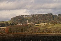
Rattray was once a burgh of itself but it was united with its larger neighbour, Blairgowrie by statute in 1228. Rattray claims to be the older and certainly Old Rattray, the area round Rattray Kirk, dates back to the 12th century. This is the higher part of the town, along the High Street.
New Rattray is the lower area along the riverbank, known as the Boat Brae, and the Balmoral Road. It was built from 1777 when the River was spanned by the Brig o' Blair.
Name
The origin of Rattray's name is uncertain. It is known only in English but some have suggested it may be an English language cognate of the Gaelic ràth, meaning fortress perhaps added to a Pictish term cognate with Welsh tref ("town").
Outside links
