Schill Moor
| Schill Moor | |||
| Northumberland | |||
|---|---|---|---|
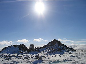
 Summit Cairn of Shill Moor in the snow | |||
| Range: | Cheviot Hills | ||
| Summit: | 1,732 feet NT944153 55°25’50"N, 2°5’15"W | ||
Schill Moor is a steep hill amongst the Cheviot Hills, in Northumberland, rising from the south side of the Breamish Valley, forcing a shallow loop in the River Breamish. It reaches 1,732 feet at its summit, which is marked by a trig point and a large cairn.
The hill is easily reached from the farm at Linhope, at the top of the road running up the Breamish Valley, and provides a starting climb for the higher peaks to the south such as Cushat Law and Bloodybush Edge and for the Kidland Forest.