Bloodybush Edge
| Bloodybush Edge | |||
| Northumberland | |||
|---|---|---|---|
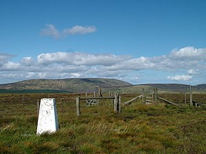
 Trig point at the summit of Bloodybush Edge | |||
| Range: | Cheviot Hills | ||
| Summit: | 2,001 feet NT903144 55°25’20"N, 2°9’10"W | ||
Bloodybush Edge is a hill amongst the Cheviot Hills, in Northumberland, to the south of the Breamish Valley, to the west of Cushat Law.
Bloodybush Edge has a rounded summit marked with a trig point.
The Kidland Forest spreads over the hill's southern slopes and beyond to the south. The ridge marking the boundary with Roxburghshire (stretching here between Windy Gyle and King's Seat. On the northern slopes, the Salter's Road runs up the Beamish Valley and on to the col between King's Seat and Windy Gyle; this is a convenient route for beginning an ascent.