Pontesbury
| Pontesbury | |
| Shropshire | |
|---|---|
 Pontesbury | |
| Location | |
| Grid reference: | SJ397061 |
| Location: | 52°38’56"N, 2°53’17"W |
| Data | |
| Population: | 3,227 (2011) |
| Post town: | Shrewsbury |
| Postcode: | SY5 |
| Dialling code: | 01743 |
| Local Government | |
| Council: | Shropshire |
| Parliamentary constituency: |
Shrewsbury & Atcham |
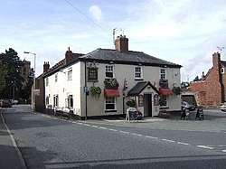
Pontesbury is a large village, of something over 3,000 people, in Shropshire, eight miles southwest of the county town, Shrewsbury. Its near neighbour is Minsterley, just over a mile further southwest. The village was founded on coal mining, though the mine has long since closed.
The A488 road runs through the village, on its way from Shrewsbury to Bishop's Castle. The Rea Brook flows close by to the north with the village itself nestling on the northern edge of the Shropshire Hills 'Area of Outstanding Natural Beauty'.
Churches

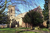
The parish church, St George's, sits in the centre of the village. Its origins of which can be traced to about 1250 AD but due to the site's circular graveyard shape may indicate a much more ancient site of Anglo Saxon origin. The church itself however was largely restored in the 19th century, following the collapse of the mediæval tower between 1820 and 1825.[1]
There are also active Baptist, Methodist and Congregationalist Churches.
The Salvation Army had a barracks in Pontesbury between about 1888-1894.[2]
About the village
Pontesbury has a good set of local shops. It has a parish council, whose purview extends over a wide area around the village itself. Pontesbury also has a primary school and also a comprehensive school, the Mary Webb School and Science College (named after the local novelist Mary Webb) which provides also a sports centre with facilities for the general public outside school hours. The village contains a medical practice, dental surgery, veterinary surgery, post office, police station, public library, public hall and cemetery.
Industries and Trade
The village has a long history of mining and quarrying, one of a number of mining villages of the Shropshire Coalfield. It was once linked to Snailbeach and Hanwood by the Minsterley branch line and the Snailbeach District Railways, it supplied local industry with coal, lead, iron and stone. Although the railway tracks are no longer there, the route that it took can still be walked, where some stations and sidings remain. Nearby Poles Coppice, around half-a-mile south of the village, contains two former quarries and is now a countryside recreation area.
Hill
Nearby is Earls Hill, which is the site of an Iron Age hillfort built around 600 B.C. and making it a Scheduled Ancient Monument and also designated a Site of Special Scientific Interest for its wildlife value. It was Shropshire Wildlife Trust's first nature reserve in 1964.
Sports Clubs
These include:
- Badminton: Pontesbury Badminton Club, formed in 1990
- Bowling: Pontesbury Bowling Club, formed in 1925
- Cricket: Pontesbury Cricket Club, formed 1875
- Football: Pontesbury Football Club, reformed 1987
Outside links
| ("Wikimedia Commons" has material about Pontesbury) |
- Pontesbury Parish Council
- Mary Webb
- The Pontesbury darts and domino league
- Gallery of Pontesbury pictures
- Pictures of Pontesbury and the area on Geograph.co.uk
References
- ↑ Whiteside, Robert (2006). The Churches and Chapels of Pontesbury Parish. funded by Local Heritage Initiative. p. 30.
- ↑ Gaydon & Lawson, A.T. & J.B. (1982). A History of Pontesbury. Shropshire Libraries. p. 292. ISBN 0-903802-23-6.Reprinted extract from Victoria History of Shropshire, Volume VIII.
