Dawley
| Dawley | |
| Shropshire | |
|---|---|
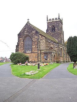
 Holy Trinity, Dawley Magna | |
| Location | |
| Grid reference: | SJ686068 |
| Location: | 52°39’50"N, 2°28’4"W |
| Data | |
| Population: | 11,399 |
| Post town: | Telford |
| Postcode: | TF4 |
| Dialling code: | 01952 |
| Local Government | |
| Council: | Telford and Wrekin |
| Parliamentary constituency: |
Telford |
Dawley is a small town in Shropshire, which today it forms part of the new town of Telford: when planned in 1963, the new town was to be named 'Dawley New Town' before it was decided in 1968 to name the town 'Telford' instead after the engineer and road builder Thomas Telford.
Somewhat older than the new-made Telford, Dawley listed in the Domesday Book of 1086. It is divided into Dawley Magna ("Great Dawley") and Little Dawley (also shown as Dawley Parva ("Little Dawley") on older maps). The town's main civil parish is officially called Great Dawley — its parish council is officially Great Dawley Town Council. Dawley Hamlets is a separate civil parish, which covers Little Dawley and other neighbouring villages/suburbs.
History
Dawley is mentioned in the Domesday Book as Dalelie, thought to be from the Old English for 'Dælla's folk's meadow'. The manor of Dalelie is recorded as having 11 inhabitants (7 villeins in Great Dawley and a surf, villein and two bordars in Little Dawley [1]
There was a castle in Dawley, but it was demolished around 1648. The site is unknown, although the Castle Pools (on the old quarry site) and Castle Ironworks (built by the Darby family, one of whom commissioned the world-famous Iron Bridge) possibly indicate the general area where it may have stood. Prior to the landscaping, following the creation of Telford New Town, extensive ruins were detectable next to the Castle Pools and are shown on old maps as being the location of the castle. In the 1980s, the whole area was buried under thick topsoil and planted with trees. Ironbridge is a short distance away.
It was, for over three centuries, a mining town, both for coal and ironstone. Clay extraction for local industrial-pipe factories, brickyards and the pottery industry has been a major influence on the landscape. The mining had an important impact on the culture. The Springwell Pit Disaster in 1872 cost eight men and boys their life.
Prior to large scale levelling as part of the development of Telford New Town, the area was covered by clay mounds and large clay pits that dominated the landscape to the extent that they formed points of reference for the locals. There is still a local clay pipe factory in the adjacent Doseley village; grey clay predominates on the immediate outskirts of Dawley.
The adjacent village of Horsehay was the site of a bridge and later a crane fabrication factory that exported around the world. The bridge over Victoria Falls is said to have been built there. Telford Steam Railway trust is located across the road from the former factory site.
Miscellany
Dawley is famed for its dialect which includes some quite unique words, including "bist", presumably a survival of the Old English, which means "are" (second person singular). The dialect is largely lost. Along with the dialect were various conventions and traditions, notably the "pig on the wall". Traditionally, Dawley residents would show their support for The Dawley Prize Band or other civic marches by placing their pigs on their wall. The pig also features in the dialect, with a romantic phrase apparently being "I wudna swop thee for a big black pig!"[2]
About the town
Dawley has a street market every Friday. Dawley town centre consists of a single pedestrianised street that was previously the main route from Bridgnorth in the south to Wellington in the north. The area around Dawley, not covered by Telford New Town, is rural and provides extensive opportunities for walking. The Ironbridge Gorge and the Wrekin are both pleasant walks from Dawley.
On the northern edge of Dawley is Malinslee where St. Leonards church stands.
The design of St. Leonards, a slightly irregular octagon, is said to have been influenced by Thomas Telford.
Other churches supposedly influenced by Thomas Telford, during his work in Shropshire, are at nearby Madeley and Bridgnorth.
Outside links
- Great Dawley Town Council
- Dawley Hamlets Parish Council
- Telford Culture Zone
- In Harmony
- Dawley Town Guide
- St Leonard's Church Malinslee
References
- ↑ Domesday Book entry – Dawley Heritage
- ↑ "Dawley Dialect". http://oldscroteshome.blogspot.com/2006/09/ow-bist-owd-jockey.html. Retrieved 7 November 2011.