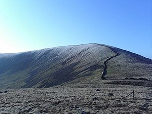
Larg Hill
From Wikishire
Revision as of 21:07, 13 April 2015 by RB (Talk | contribs) (Created page with "{{Infobox hill |name=Larg Hill |county=Kirkcudbrightshire |range=Galloway Hills |picture=Larg Hill - geograph.org.uk - 457886.jpg |picture caption=Larg Hill |os grid ref=NX413...")
| Larg Hill | |||
| Kirkcudbrightshire | |||
|---|---|---|---|
 Larg Hill | |||
| Range: | Galloway Hills | ||
| Summit: | 2,216 feet NX413750 55°2’41"N, 4°29’4"W | ||
Larg Hill is in northern Kirkcudbrightshire, part of the Galloway Hills and within the Galloway Forest Park. It rises to 2,216 feet and is to be found south of Lamachan Hill.
From the western slope of Larg Hill runs the Pulniskie Burn down join the River Cree at Larg.