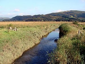
River Llyfnant

The River Llyfnant flows near Eglwys Fach in Cardiganshire, flowing through the north of the county and eventually discharging to the Dovey estuary.
The river rises in the Cambrian Mountains. It reaches the hill walk of Uwch Garreg, and then while still a young river plunges over the waterfalls known as Pistyll y Llyn, into the ravine that the river carves northwards through the mountain. The ravine continues for the whole course of the river until it opens to the Dovey estuary.
The Cambrian Coast Line from Shrewsbury crosses the Llyfnant into Cardiganshire after Dovey Junction station, at the mouth of the river. The A487 Machynlleth to Aberystwyth road crosses a few hundred yards above this at Pont Llyfnant, at the point the river becomes tidal.
The area has a healthy population of red kites.[1]
References
- ↑ Barnes, p.58
- Location map: 52°33’-0"N, 3°56’13"W
- "The Companion Guide to Wales", David Barnes, Published by Companion Guides, 2005, ISBN 1-900639-43-2, ISBN 978-1-900639-43-9