Botley, Buckinghamshire
| Botley | |
| Buckinghamshire | |
|---|---|
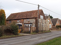
 Houses in Botley | |
| Location | |
| Grid reference: | SP983022 |
| Location: | 51°42’38"N, -0°34’41"W |
| Data | |
| Postcode: | HP5 |
| Local Government | |
| Council: | Buckinghamshire |
| Parliamentary constituency: |
Chesham and Amersham |
Botley is a hamlet by Chesham, in Buckinghamshire.
The name of the hamlet is from Old English, and means Botta's Meadow.
Botley includes the Hen and Chickens pub, Botley Stores shop and Goose Acre pond. Most of the houses in Botley are on Botley Road. Botley is divided between the civil parishes of Chesham and Latimer. Botley merges into the village of Ley Hill.