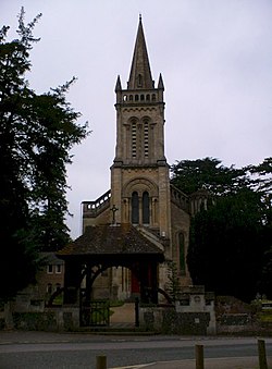
Shaw, Berkshire
| Shaw | |
| Berkshire | |
|---|---|

| |
| Location | |
| Grid reference: | SU486680 |
| Location: | 51°24’32"N, 1°18’9"W |
| Data | |
| Postcode: | RG14 |
| Local Government | |
| Council: | West Berkshire |
| Parliamentary constituency: |
Newbury |
Shaw is a village in Berkshire, to the north of Newbury, adjoining a similar village to the west, Donnington and barely separated from Thatcham to the east. With Donnington, Shaw forms a joint civil parish named 'Shaw-cum-Donnington'; both villages are effectively contiguous with Newbury to the south, seaparated only by the River Kennet and the Kennet and Avon Canal.
Shaw House
An Elizabethan stately home, named Shaw House, stands in the village. It was one of the Royalist headquarters during the Second Battle of Newbury and, later, the home of the childhood home of the historian, James Pettit Andrews. It is now a conference centre owned by the local council.
Outside links
| ("Wikimedia Commons" has material about Shaw, Berkshire) |
References

This Berkshire article is a stub: help to improve Wikishire by building it up.
