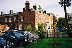
Newell Green
| Newell Green | |
| Berkshire | |
|---|---|
 Newell Hall | |
| Location | |
| Grid reference: | SU878712 |
| Location: | 51°25’59"N, -0°44’18"W |
| Data | |
| Post town: | Bracknell |
| Postcode: | RG42 |
| Dialling code: | 01344 |
| Local Government | |
| Council: | Bracknell Forest |
| Parliamentary constituency: |
Windsor |
Newell Green is a hamlet in Berkshire, close to Warfield, in whole broad parish. It is dangerously close to the swelling town of Bracknell to the south, separated by just a few hundred yards.
Many are the villages and hamlets in the Parish of Warfield, a rural area: Warfield itself is a mere hamlet, smaller than Newell Green and to the north. To west and east are Cabbage Hill and Winkfield Green.

The stream known as The Cut runs by Newell Green, and there is a ford across the stream here. Eventually the Cut joins the River Thames at Bray.
Outside links
| ("Wikimedia Commons" has material about Warfield) |
