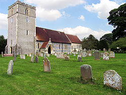
Chieveley
| Chieveley | |
| Berkshire | |
|---|---|
 St Mary's Church | |
| Location | |
| Grid reference: | SU474738 |
| Location: | 51°27’40"N, 1°19’8"W |
| Data | |
| Population: | 1,481 (2001) |
| Post town: | Newbury |
| Postcode: | RG20 |
| Dialling code: | 01635 |
| Local Government | |
| Council: | West Berkshire |
| Parliamentary constituency: |
Newbury |
| Website: | MyChieveley.co.uk |
Chieveley is a village in Berkshire about 4 miles north of Newbury, and uncomfortably close to the M4 motorway and the A34 road: Chieveley Services serve Junction 13 of the M4 motorway close by.
The village had 1,481 folk as at the 2001 census, in 508 households. It sits in a landscape of gently rolling chalk hills, the land predominantly arable with some dairy, sheep and pigs. There is a healthy quantity of woodland and abundant wildlife. There is a network of green lanes and footpaths that afford good walking. There are currently three working farms in the parish. Other industries include a garden centre, land-fill site, hotels, baker and many small businesses.
Also within the civil parish is another village, Curridge, and a scatter of hamlets; Downend, Oare and Snelsmore Common. The original parish also included Leckhampstead and Winterbourne.
History
The parish boasts a fine Iron Age hill fort in Snelsmore, called Bussock Camp. This is in private grounds but is visible in May when they are opened to the public to view the fine display of bluebells.
The name Chieveley is said to be derived from 'Field of Chives'. The Women's Institute's 'Berkshire Book' assures the reader that chives were noted in the area as far back as 951; maybe not as such, but this is year in which King Edred gave the village to his bailiff, Wulf.
The Domesday Book of 1086 says of Chieveley:
- In Rowbury Hundred
- The abbey itself holds Chieveley. It has always held it. Iin the reign of King Edward it was assessed at 27 hides; now at 7½ hides. There is land for 20 ploughs. In demesne are 3 ploughs; and 28 villains and 10 bordars with 18 ploughs. There are 3 slaves, and 4 acres of meadow, [and] woodland for 60 pigs. Of this land William holds of the abbot 5 hides, and Godfrey 1½ hides, and there is 1 plough, with 3 villains and 2 bordars having 1 plough, and 3 acres of meadow. The whole, in the time of King Edward and afterwards, was worth 12l; now the abbot's portion [is worth] 10l; [that] of his men 50s.
In August 1207, King John is reported to have been in Curridge on the 3rd August and in Chieveley on the 5th, presumably hunting.
The first vicar of Chieveley was Elias, appointed in 1154. It is likely that there was an Anglo-Saxon church before it was replaced by the Normans and later the Victorians. Chieveley parish registers start on 10 April 1560.
Chieveley once had a maypole, stored on the site now occupied by Maypole Cottage (on the corner of the High Street and Church Lane).
Outside links
| ("Wikimedia Commons" has material about Chieveley) |
