Bodfari
| Bodfari | |
| Flintshire | |
|---|---|
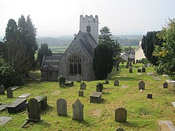
 St Stephen's Parish Church | |
| Location | |
| Grid reference: | SJ093701 |
| Location: | 53°12’36"N, 3°21’36"W |
| Data | |
| Post town: | Denbigh |
| Postcode: | LL16 |
| Dialling code: | 01745 |
| Local Government | |
| Council: | Denbighshire |
| Parliamentary constituency: |
Vale of Clwyd |
Bodfari is a village in Flintshire on the north bank of the River Wheeler, which here forms the border with Denbighshire.
The ancient parish of Bodfari comprises the townships of Bodfari in Flintshire and Aberwheeler, in Denbighshire.
Location
The village lies on the A541 road at the point where the road passes through a gap in the Clwydian Hills, the gap being part of the valley of the River Wheeler.
The Offa's Dyke Path passes through the village, and for walkers completing the trail south to north, Bodfari is usually the final overnight stop on the 177-mile route.
Outside links


This Flintshire article is a stub: help to improve Wikishire by building it up.