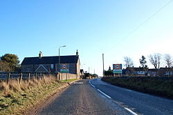
Craichie
| Craichie | |
| Angus | |
|---|---|
 Craichie | |
| Location | |
| Grid reference: | NO503473 |
| Location: | 56°36’54"N, 2°48’41"W |
| Data | |
| Post town: | Forfar |
| Postcode: | DD8 |
| Dialling code: | 01307 |
| Local Government | |
| Council: | Angus |
| Parliamentary constituency: |
Angus |
Craichie (formerly spelled Craquhy) is a small village in the parish of Dunnichen in Angus, three miles south-east of Forfar on the B9128 Carnoustie to Forfar road.
The village is mentioned in 1329 in the "Registers of the Abbey of Arbroath". The Registers record that they lands of Craichie were owned by Walter de Tulloch in 1438, and Alexander of Sturrock in 1509.[1]
Craichie had a primary school from 1900 until the 1980s which served the village as well as the surrounding area.
References
- ↑ Registrum de Aberbrothoc, pub 1856