Carmyllie
| Carmyllie | |
| Angus | |
|---|---|
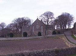
 Carmyllie Parish Church | |
| Location | |
| Grid reference: | NO550420 |
| Location: | 56°34’6"N, 2°43’54"W |
| Data | |
| Post town: | Arbroath |
| Postcode: | DD11 |
| Dialling code: | 01241 |
| Local Government | |
| Council: | Angus |
| Parliamentary constituency: |
Angus |
Carmyllie is a rural parish in Angus. The village stands on high ground between Arbroath, on the coast, and the inland county town of Forfar.
The main settlements in the parish are Redford, Greystone and Milton of Carmyllie. The Elliot Water rises in the west of the parish.
There is a Church of Scotland church and a primary school. Carmyllie post office was closed in September 2008.
History
Carmyllie was once known for its stone sandstone quarries. For many centuries these produced high quality sandstone that was shipped all over the world.[1]
Between 1900 and 1965 Carmyllie was linked by to Arbroath by the Carmyllie Light Railway.[2]
Carmyllie has a traditional association with Clan Strachan.