Coalford
| Coalford | |
| Aberdeenshire | |
|---|---|
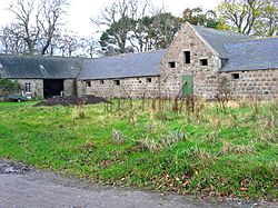
 Hilton Farm near Coalford | |
| Location | |
| Grid reference: | NO821997 |
| Location: | 57°5’21"N, 2°17’43"W |
| Data | |
| Postcode: | AB31 |
| Local Government | |
| Council: | Aberdeenshire |
Coalford is a village in Aberdeenshire, standing slightly north of the River Dee and just southwest of Peterculter. A statue of Rob Roy MacGregor stands near Coalford.
A number of noted historical structures lie in the vicinity of Coalford including Crathes Castle, Muchalls Castle, Maryculter House and the Lairhillock Inn.
Considerable prehistoric remains have been found in the local region along the Deeside, as evinced by the ancient sites of Balbridie and Bucharn.[1]
Coalford is situated near the ancient Roman Camp of Normandykes, which was accessed by a march northward from Raedykes via the Elsick Mounth trackway.[2]
References
- ↑ Archibald Watt, Highways and Byways around Kincardineshire, Stonehaven Heritage Society (1985)
- ↑ C. Michael Hogan, Elsick Mounth, Megalithic Portal, ed A. Burnham