St Levan
| St Levan | |
| Cornwall | |
|---|---|
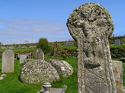
 St Levan churchyard | |
| Location | |
| Grid reference: | SW3822 |
| Location: | 50°2’28"N, 5°39’43"W |
| Data | |
| Population: | 487 (2001) |
| Post town: | Penzance |
| Postcode: | TR19 |
| Dialling code: | 01736 |
| Local Government | |
| Council: | Cornwall |
| Parliamentary constituency: |
St Ives |
St Levan is a village on the Penwith peninsula in the west of Cornwall. The village is about eight miles southwest of Penzance.
St Levan lies, as does about a third of the county, within the Cornwall Area of Outstanding Natural Beauty.
The parish encompasses the settlements of St Levan, Trethewey, Treen (the chief village), and Porthcurno and shares boundaries with the parishes of Sennen in the northwest, St Buryan in the north-east (with which it has close ties). It is bounded by the sea in the south and was at one point part of St Buryan parish. The parish encompasses 2,402 acres of dry land, 3 acres of water and 31 acres of foreshore.
Parish church
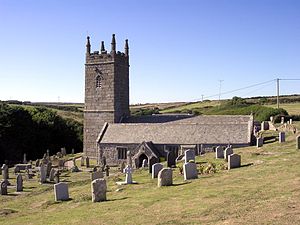
The parish church is the Church of Saint Levan's Church.
Outside links

| ("Wikimedia Commons" has material about St Levan) |
References
