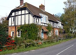
Horsebridge, Hampshire
| Horsebridge | |
| Hampshire | |
|---|---|
 House at Horsebridge | |
| Location | |
| Grid reference: | SU35132983 |
| Location: | 51°4’0"N, 1°29’60"W |
| Data | |
| Post town: | Andover |
| Postcode: | SO20 |
| Dialling code: | 01264 |
| Local Government | |
| Council: | Test Valley |
| Parliamentary constituency: |
North West Hampshire |
Horsebridge is a small village in Hampshire, close by the larger village of King's Somborne (with which it shares a parish council). It is in the Test Valley: the river splits into several streams here creating broad flood meadows, and the bridge which gives the village its name crosses the Park Stream, one of those backwaters, at the western edge of the village, bearing the road north-westwards and over the main stream of the Test a mile or so beyond.
Horsebridge is found off the A4057. The Monarch's Way long-distance path runs through the village.
The nearest town is Stockbridge, which lies approximately 3½ miles northeast of the village. The village has one pub, named the John O'Gaunt Inn.[1]
The village formerly had its own railway station, which ran between Romsey and Andover, but this was closed down in 1962.[2][3]