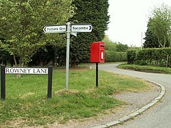
Sacombe Green
| Sacombe | |
| Hertfordshire | |
|---|---|
 Sacombe Green | |
| Location | |
| Grid reference: | TL345195 |
| Location: | 51°51’28"N, 0°2’54"W |
| Data | |
| Population: | 165 |
| Post town: | Ware |
| Postcode: | SG12 |
| Dialling code: | 01920 |
| Local Government | |
| Council: | East Hertfordshire |
| Parliamentary constituency: |
North East Hertfordshire |
Sacombe Green is a hamlet found to the east of the village of Sacombe, in Hertfordshire. The path of a Roman road is believed to join the two villages, running towards the major Roman road, Ermine Street just to the east, which latter route became the Cambridge Road and now the A10 corridor.
To the east of Sacombe Green, on Ermine Street, are High Cross and Standon Green End.