Altrincham
| Altrincham | |
| Cheshire | |
|---|---|
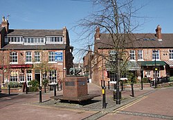 Goose Green in Altrincham | |
| Location | |
| Grid reference: | SJ765875 |
| Location: | 53°23’2"N, 2°21’17"W |
| Data | |
| Population: | 40,695 (2001) |
| Post town: | Altrincham |
| Postcode: | WA14 & WA15 |
| Dialling code: | 0161 |
| Local Government | |
| Council: | Trafford |
| Parliamentary constituency: |
Altrincham and Sale West |
Altrincham is a market town in Cheshire, tight to the grip of the conurbation of towns spreading from Manchester. It stands on flat ground south of the River Mersey about 8 miles southwest of Manchester city centre, and 3 miles south-southwest of Sale. As of the 2001 UK census, it had a population of about 41,000.
Altrincham was established as a market town in 1290, a time when most communities were based around agriculture rather than trade, and there is still a market in the town today. Further socioeconomic development came with the extension of the Bridgewater Canal to Altrincham in 1765 and the arrival of the railway in 1849, stimulating industrial activity in the town. Outlying villages were absorbed by Altrincham's subsequent growth, along with the grounds of Dunham Massey Hall, formerly the home of the Earl of Stamford, and now a tourist attraction with three Grade I listed buildings and a deer park.
Altrincham today is an affluent commuter town, partly because of its transport links. The town has a strong middle class presence; there has been a steady increase in Altrincham's middle classes since the 19th century.
Name

The name Altrincham first appears as "Aldringeham", probably meaning "homestead of Aldhere's people".[1] As recently as the 19th century it was spelt both "Altrincham" and "Altringham".[2]
History
The remains of a Roman road run through the Broadheath area, part of one of the major Roman roads in Cheshire and Lancashire connecting the legionary fortresses of Chester (Deva Victrix) and York (Eboracum). As it shows signs of having been repaired, the road was in use for a considerable period of time.[3]
Until the Normans came, the manors surrounding Altrincham were owned by the Saxon thegn Alweard; after the invasion they became the property of Hamon de Massey,[1][4] though Altrincham was not itself a manor and so is not listed in the Domesday Book. The earliest documented reference to the town is from 1290,[5] when it was granted its charter as a Free Borough by Baron Hamon de Massey V.[6] The charter allowed a weekly market to be held, and it is possible that de Massey established the town to generate income through taxes on trade and tolls. This suggests that Altrincham may have been a planned market town, unusual during the Middle Ages, when most communities were agricultural.[7] Altrincham was probably chosen as the site of the planned town rather than Dunham – which would have been protected by Dunham Castle – because its good access to roads was important for trade.[8]
Altrincham became a Free Borough, a self governing township, when it was granted a charter in June 1290 by the Lord of the Manor, Hamon de Massey V. The charter allowed for the creation of a merchants' guild, run by the town's burgesses to tax people passing through the borough.[9] Burgesses were free men who lived in the town.[10] The borough was ruled by a Court Leet and elected a mayor since at least 1452. Amongst the court's responsibilities were keeping the public peace and regulating the markets and fairs.[11]
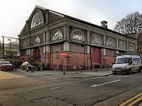
Altrincham Fair became St James's Fair or Samjam in 1319 and continued until 1895. Fair days had their own Court of Pye Powder, the market court, presided over by the mayor and held to settle disputes arising from the day's dealings.[12] By 1348 the town had 120 burgage plots – ownership of land used as a measure of status and importance in an area – putting it on a par with the Cheshire town of Macclesfield and above Stockport and Knutsford.[13]
The earliest known residence in Altrincham was The Knoll, on Stamford Street near the centre of the mediæval town. An 1983 excavation on the demolished building, made by South Trafford Archaeological Group, discovered evidence that the house dated from the 13th or 14th century, and that it may have contained a drying kiln or malting floor.[14]
In 1754, a stretch of road south of Altrincham, along the Manchester to Chester route, was turnpike and further sections were turnpiked in 1765 from Timperley to Sale, and 1821 from Altrincham to Stockport. The connection of the Bridgewater Canal to Altrincham in 1765 stimulated the development of market gardening, and for many years Altrincham was noted for its vegetables.[15] By 1767, warehouses had been built alongside the canal at Broadheath, the first step in the development of Broadheath as an industrial area and the beginning of Altrincham's industrialisation. The canal was connected in 1776 to the River Mersey, providing the town not only with a water route to Manchester, but also to the Irish Sea.[16]
The railway came in 1849 and two stations opened in the town: Altrincham, on Stockport Road, and Bowdon – though not actually in Bowdon – on Lloyd Street/Railway Street. Both were replaced in 1881 by Altrincham & Bowdon station on Stamford New Road.[17] The London and North Western Railway's station at Broadheath, on the town's northern edge, was opened in 1854, while a further connection was created on 12 May 1862 by the Cheshire Midland Railway (later the Cheshire Lines Committee), who opened their line from Altrincham to Knutsford.[18]
With its new railway links, Altrincham and the surrounding areas became desirable places for the middle classes and commuters to live.[17][19] Professionals and industrialists moved to the town, commuting into Manchester. While some travelled daily by coach, the less well–to–do commuted by express or "flyer" barges from Broadheath.[20] Between 1851 and 1881 the population increased from 4,488 to 11,250.[21]
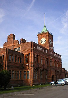
Broadheath's industrial area, covering about 250 acres, was founded in 1885 by Harry Grey, 8th Earl of Stamford, to attract businesses. By 1900 Broadheath had its own docks, warehouses and electricity generating station. The site's proximity to rail, canal and road links proved attractive to companies making machine tools, cameras and grinding machines. The presence of companies like Tilghmans Sand Blast, and the Linotype and Machinery Company, established Broadheath as an industrial area of national standing. By 1914, 14 companies operated in Broadheath, employing thousands of workers. One of those was the Budenberg Gauge Company. Linotype also created 172 workers' homes near its factory, helping cater for the population boom created by Broadheath's industrialisation. Between 1891 and 1901 the population of Altrincham increased by 35%, from 12,440 to 16,831.[22]
From the turn of the 20th century to the start of the Second World War, there were few changes in Altrincham. Although the town was witness to some of the Luftwaffe's raids on the south Lancashire industrial towns, it emerged from the war relatively unscathed, and as with the rest of Britain, experienced an economic boom. This manifested itself in the construction of new housing and the 1960s rebuilding of the town centre. However, during the 1970s employment at Broadheath declined by nearly 40 per cent.[23]
Churches
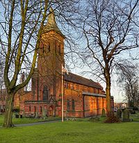
Until the modern period, Altrincham was part of Bowdon parish. Low population density meant that the town did not have a church until a chapel of ease was built in 1799. Nonconformist came to Altrincham before then; Methodists set a chapel up in 1790. The Baptists followed in the 1870s.[24][25] Irish immigrants in the 1830s and 1840s brought Roman Catholicism to the area, the first Roman church built in Altrincham was St Vincent's, in 1860.[26]
Now there are several churches in Altrincham, a number being Grade II listed buildings.
- Christ Church,[27]
- St Alban's, Broadheath[28]
- St George's[29]
- St John the Evangelist[30]
- Trinity United Reformed Church[31]
Grade II*:
Sights about the town
The Old Market Place is thought to stand on the site of the original town settlement. Now a registered conservation area it consists of a series of part timber-framed buildings echoing the wattle and daub constructions of the original houses and burgage plots. The cobblestone paving was replaced in 1896. The Buttermarket which stood in the area near the Old Market Place from the 17th century until the late 19th century was also the site for dispensing early local justice.
A courtroom, stocks and whipping post saw public floggings take place there until the early 19th century. The whipping post and stocks were restored as a tourist attraction by local traders in the 1990s, but restored in look, not to deal with late night troublemakers.
In 1814 Thomas de Quincey described the Old Market Place in his Confessions of an English Opium Eater while travelling from Manchester to Chester. He noted how little the place had changed since his visit 14 years earlier at the age of three, and that "fruits, such as can be had in July, and flowers were scattered about in profusion: even the stalls of the butchers, from their brilliant cleanliness, appeared attractive: and bonny young women of Altrincham were all tripping about in caps and aprons coquettishly disposed".[35] Another of Altrincham's attractions is the historic market, set up over 700 years ago when the town was first established.[36]
Of the 21 conservation areas in Trafford, ten are in Altrincham: The Downs, The Devisdale, Bowdon, Ashley Heath, Goose Green, Old Market Place, Sandiway, George Street, the Linotype Housing Estate and Stamford New Road.[37]
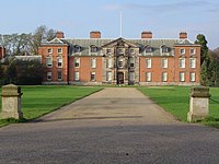
Dunham Massey stands on the town's outskirts, an 18th-century hall[38] surrounded by its 250 acre deer park, both now owned by the National Trust. The hall is early Georgian in style, and along with its stables and carriage house, is a Grade I listed building.[39]
Royd House was built between 1914 and 1916, by local architect Edgar Wood, as his own residence. It has a flat concrete roof, a concave façade, and is faced in Portland red stone and Lancashire brick.[40] It is regarded as one of the most advanced examples of early 20th-century domestic architecture, and is referenced in architectural digests. It has been a Grade I listed building since 1975, one of six such buildings in Trafford.[41]
The Grade II listed clock outside the main transport interchange was built in 1880.[42]
The 16 acre Stamford Park was designed by landscape gardener John Shaw. It opened to the public in 1880, as a sports park with areas for cricket and football. The land was donated by George Grey, 7th Earl of Stamford and is now owned and run by the council. The park is listed as Grade II on the National Register of Historic Parks and Gardens|Register of Parks and Gardens of Special Historic Interest in England,[43] and has won a bronze award from the Greenspace award scheme.[44]
Events and venues
- Altrincham Garrick Playhouse
- The Club Theatre.
The Altrincham Garrick group was formed in 1913.
The Club Theatre group began in 1896, as the St Margaret's Church Institute Amateur Dramatics Society. It provides a venue for the Trafford Youth Theatre production each year, and it runs the Hale One Act Festival, an annual week-long event started in 1972.[45] The club has received awards from both the Greater Manchester Drama Federation and the Mid-Cheshire Theatre Guild.[46] Altrincham also had Greater Manchester's only Michelin starred restaurant, the Juniper.[47]
Sport
- Football: Altrincham FC, nicknamed "The Robins", founded in 1903
Outside links
References
- ↑ 1.0 1.1 Dore (1972), p. 12.
- ↑ Nickson (1935), pp. 3–4.
- ↑ Nevell (1997), p. 18.
- ↑ Nevell (1997), p. 27.
- ↑ Nevell (1997), p. 32.
- ↑ Nevell (1997), pp. 39, 52.
- ↑ Nevell (1997), p. 51.
- ↑ Bayliss (1992), p. 18.
- ↑ Nickson (1935), p. 9.
- ↑ Bayliss (1992), p. 14.
- ↑ Nickson (1935), pp. 11–13.
- ↑ "Altrincham History". Altrincham History Society. http://althistsoc.users.btopenworld.com/history.html. Retrieved 24 July 2007.
- ↑ Nevell (1997), p. 52.
- ↑ Faulkner, P (2005). "The Knoll, Altrincham". South Trafford Archaeological Group. http://homepage.ntlworld.com/bryan.burtonbj/The%20Knoll%20Altrincham.htm. Retrieved 11 September 2007.
- ↑ McNeil & Nevell (2000), p. 61.
- ↑ Nevell (1997), p. 92.
- ↑ 17.0 17.1 Nevell, Mike: The Archaeology of Trafford (1997), University of Manchester Archaeological Unit. ISBN 1-870695-25-9.
- ↑ Dixon (1994)
- ↑ Bamford (1995)
- ↑ Nevell (1997), p. 87.
- ↑ Nevell (1997), pp. 126–130.
- ↑ Bamford (1991), pp. 78, 85.
- ↑ Bayliss (1992), p. 58.
- ↑ Nevell (1997) pp. 106–107.
- ↑ Nevell (1997) pp. 107–108.
- ↑ Images of England — details from listed building database (212792)
- ↑ Images of England — details from listed building database (212766)
- ↑ Images of England — details from listed building database (212754)
- ↑ Images of England — details from listed building database (212784)
- ↑ Images of England — details from listed building database (212797) Trinity United Reformed Church
- ↑ Images of England — details from listed building database (212760) Church of St Margaret
- ↑ Images of England — details from listed building database (436249)
- ↑ Images of England — details from listed building database (212885)
- ↑ De Quincey (1994), pp. 75–76.
- ↑ "Welcome to Altrincham Market". Trafford MBC. http://www.trafford.gov.uk/altrinchammarket/. Retrieved 22 March 2012.
- ↑ "Conservation Areas in Trafford". Trafford MBC. 1 May 2008. http://www.trafford.gov.uk/environmentandplanning/planning/conservationareas/conservationareasintrafford/. Retrieved 23 March 2012.
- ↑ Images of England — details from listed building database (212842)
- ↑ "Dunham Massey". National Trust. http://www.nationaltrust.org.uk/main/w-vh/w-visits/w-findaplace/w-dunhammassey. Retrieved 11 July 2007.
- ↑ Miller, Keith (24 March 2001). "When diamonds were a man's best trend". telegraph.co.uk (Telegraph Media Group Limited). http://www.telegraph.co.uk/property/4813575/When-diamonds-were-a-mans-best-trend.html. Retrieved 13 February 2012.
- ↑ Images of England — details from listed building database (212892)
- ↑ Images of England — details from listed building database (212789)
- ↑ "Welcome to Stamford Park". Friends of Stamford Park. http://www.friendsofstamfordpark.org.uk/home.htm. Retrieved 10 July 2007.
•"The historical significance of Stamford Park" (PDF). Friends of Stamford Park. http://www.friendsofstamfordpark.org.uk/images/PDF2.pdf. Retrieved 10 July 2007. - ↑ "Parks pass 'green flag' test" (PDF). Trafford.gov.uk. January 2008. p. 4. http://www.trafford.gov.uk/news/traffordtoday/2008/jan-08.pdf. Retrieved 13 February 2012.
- ↑ "The history of the Hale One Act Festival". The Club Theatre. http://www.clubtheatre.org.uk/Hale%20Festival/hale%20history.htm. Retrieved 10 July 2007.
- ↑ "Theatre history". The Club Theatre. http://www.clubtheatre.org.uk/cthistory.htm. Retrieved 10 July 2007.
- ↑ "Michelin star restaurants in the UK". Andy Hayler's Restaurant Guide. 2007. http://www.michelinrestaurantsguide.com/michelin-uk-restaurants.asp. Retrieved 11 July 2007.
Books
- Awdry, Christopher (1990). Encyclopedia of British Railway Companies. Patrick Stephens Ltd. ISBN 1-85260-049-7.
- Bamford, Frank (1991). The Making of Altrincham, 1850–1991: from market to megastore?. Altrincham: Frank Bamford. ISBN 0-9517225-1-4.
- Bamford, Frank (1995). Broadheath 1885–1985: a century of industry. Altrincham: Frank Bamford. ISBN 0-9517225-2-2.
- Bayliss, Don (1992). Altrincham: a history. Altrincham: Willow Publishing. ISBN 0-946361-33-9.
- De Quincey, Thomas ([1994] 1821). Confessions of an English Opium-eater. Wordsworth Editions. ISBN 978-1-85326-096-4.
- Dixon, Frank (1994). The Manchester South Junction and Altrincham Railway. The Oakwood Press. ISBN 0-85361-454-7.* Dore, R N (1972). A History of Hale, Cheshire: From Domesday to Dormitory. Altrincham: John Sherratt and Son Ltd. ISBN 0-85427-030-2.
- Frangopulo, N J (1977). Tradition in Action: The Historical Evolution of the Greater Manchester County. Wakefield: EP Publishing. ISBN 978-0-7158-1203-7.
- McNeil, R; Mike Nevell (2000). A Guide to the Industrial Archaeology of Greater Manchester. Association for Industrial Archaeology. ISBN 0-9528930-3-7.
- Nevell, Mike (1997). The Archaeology of Trafford. Trafford Metropolitan Borough with University of Manchester Archaeological Unit. ISBN 1-870695-25-9.
- Nickson, Chas (1935). Bygone Altrincham. Didsbury: E.J. Morten. ISBN 0-901598-30-5.
- Taylor, B J; R H Price and Frederick Murray Trotter (1963). Geology of the Country around Stockport and Knutsford. Memoirs of the Geological Survey of Great Britain.