Template:Infobox town/doc
Jump to navigation
Jump to search
Usage
Blank template
{{Infobox town
| name=
| welsh=
| gaelic=
| irish=
| scots=
| cornish=
| county=
| riding=
| picture=
| picture caption=
| latitude=
| longitude=
| os grid ref=
| population=
| census year=
| post town=
| postcode=
| dialling code=
| LG district=
| constituency=
| website=
}}
Examples
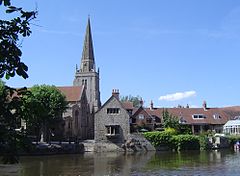
Example 1: Abingdon
| Abingdon | |
| Berkshire | |
|---|---|
 The River Thames at Abingdon looking towards St. Helen's parish church | |
| Location | |
| Location: | 51.667 N, -1.283 W |
| Grid reference: | SU4997 |
| Data | |
| Population: | 36,626 |
| Post town: | Abingdon |
| Postcode: | OX14 |
| Dialling code: | 01235 |
| Local Government | |
| Council: | Vale of White Horse |
| Parliamentary constituency: |
Oxford West and Abingdon |
| Website: | Abingdon Town Council |
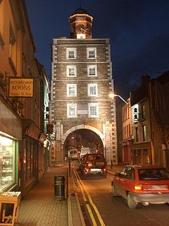
Example 2: Youghal
| Youghal Irish: Eochaill | |
| County Cork | |
|---|---|
 The Clock Gate | |
| Location | |
| Location: | 51.951671 N, -7.845612 W |
| Grid reference: | X102781 |
| Data | |
| Population: | 6393 |
| Local Government | |
| Website: | www.youghal.ie |