Llanfallteg
| Llanfallteg | |
| Carmarthenshire | |
|---|---|

| |
| Location | |
| Grid reference: | SN163192 |
| Location: | 51°50’30"N, 4°40’4"W |
| Data | |
| Local Government | |
| Council: | Carmarthenshire |
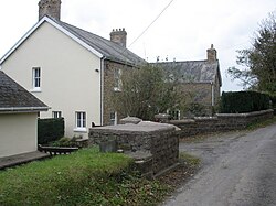
Llanfallteg is a village in Carmarthenshire. It stands on the east bank of the River Taf, which here marks the boundary between Carmarthenshire on the east and Pembrokeshire on the west. Its neighbouring hamlet, Llanfallteg West., is across the river in Pembrokeshire.
The Llanfallteg Memorial Playing Field in the village has been enrolled as a Queen Elizabeth II Field, an endeavour marking her Majesty's Diamond Jubilee in 2012.