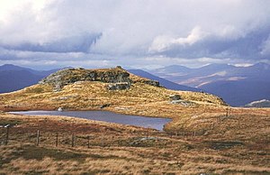
Beinn a' Chòin
| Beinn a' Choin | |||
| Dunbartonshire, Stirlingshire | |||
|---|---|---|---|
 Beinn a' Choin's summit | |||
| Range: | Trossachs Hills | ||
| Summit: | 2,523 feet NN354130 56°16’52"N, 4°39’36"W | ||
Beinn a' Choin is a mountain of 2,523 feet on the border of Dunbartonshire with Stirlingshire, in the northernmost, Highland reach of Dunbartonshire, among the @Mountains.
The mountain stands at the northern end of Loch Lomond, overlooking the loch below its western slope.
A rugged and wild mountain of rocks and moorland, it is to the north of Ben Lomond, and is usually climbed from the hamlet at of Inversnaid.[1]
References
- ↑ Beinn a' Choin: WalkHighlands