Bradley, Gloucestershire
| Bradley Court | |
| Gloucestershire | |
|---|---|
 Bradley Court | |
| Location | |
| Grid reference: | ST747936 |
| Location: | 51°38’28"N, 2°21’58"W |
| Data | |
| Postcode: | GL12 |
| Local Government | |
| Council: | Stroud |
Bradley is a small village in Gloucestershire.
Also part of the village is a hamlet, Bradley Green, with its eponymous area of common land, still used for agriculture today.
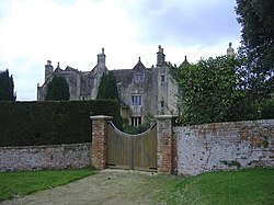
Buildings of note in the village include the Grade II listed Bradley Court, once owned by the Berkeleys of Berkeley Castle and various former weavers' cottages which front on to Bradley Green itself. Within sight are Swinhay House, Wotton Hill and the Tyndale Monument.
Just to the south-east is Wotton-under-Edge. Nearby villages include Kingswood, North Nibley and Charfield.