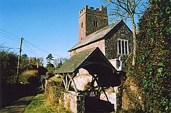
Upton Hellions
| Upton Hellions | |
| Devon | |
|---|---|
 St Mary's, Upton Hellions | |
| Location | |
| Grid reference: | SS841033 |
| Location: | 50°49’5"N, 3°38’46"W |
| Data | |
| Postcode: | EX17 |
| Local Government | |
| Council: | Mid Devon |
Upton Hellions is a village in the midst of Devon, on its own at the end of a dead-end lane above the valley of the River Creedy, which runs just a few hundred yards to the west, heading south to Crediton, two miles south of Upton Hellions. Across the valley to the south-west is Sandford. A mile and a half to the north but joined only by footpaths is a similar hamlet, East Village.
Though small and apart, the village has a parish church, St Mary the Virgin; one of three churches in the Parish of Sandford and Upton Hellions.
Outside links
| ("Wikimedia Commons" has material about Upton Hellions) |

This Devon article is a stub: help to improve Wikishire by building it up.
