Oldbury, Kent
| Oldbury | |
| Kent | |
|---|---|
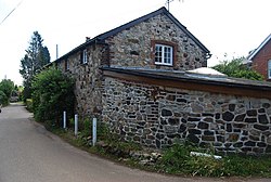
 Cottage on Oldbury Lane | |
| Location | |
| Grid reference: | TQ587564 |
| Location: | 51°17’6"N, -0°16’28"E |
| Data | |
| Postcode: | TN15 |
| Local Government | |
| Council: | Tonbridge and Malling |
Oldbury is a hamlet in Kent, on the west side of the village of Ightham, to which it is effectively attached.
Beside the hamlet on Ightham Common are the earthworks of a large, Iron Age fortress, known as Oldbury Camp, or just 'Oldbury': the hamlet takes its name from the fort, the name being the Old English Eald byrig; 'old fort'. The southern half of the fort site is now owned by the National Trust, which also owns Ightham Mote, a manor house to the south.
Outside links
- Oldbury Hill – National Trust