Green Lowther
| Green Lowther | |||
| Lanarkshire | |||
|---|---|---|---|
 Green Lowther | |||
| Range: | Lowther Hills | ||
| Summit: | 2,403 feet NS90081200 55°23’23"N, 3°44’12"W | ||
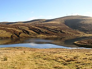
Green Lowther is a mountain of 2,403 feet, and the highest of the Lowther Hills. Green Lowther is in the south of Lanarkshire, a mile from the border with Kirkcudbrightshire, which is marked here by the summit of Lowther Hill (2,377 feet) to the southwest.
Green Lowther and Lowther Hill may be considered one mountain, their peaks linked by a mile-long ridge which does not drop below 2,100 feet and which extends north-east of Green Lowther to Dungrain Law (2,186 feet).
Air Traffic Control

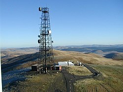
The NATS Green Lowther Transmitter Station stands at the summit, operated by National Air Traffic Services. An NATS radar system stands on Lowther Hill too. A metalled track has been driven up the hills to serve the two stations.