Portsea Island
| Portsea | |
 Portsea and Hayling Island | |
|---|---|
| Location | |
| Location: | 50°48’34"N, 1°4’18"W |
| Grid reference: | SU655015 |
| Area: | 10 square miles |
| Data | |
| Population: | 147,088 |
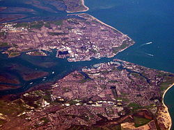
Portsea Island is a small, flat and low lying island if Hampshire on south coast of Great Britain, separated by narrow channels from the mainland. The island is totally within, and contains a large proportion of, the city of Portsmouth. It has the largest population of any island in the British Isles, after the mainlands of Great Britain and Ireland.
To the east lies Langstone Harbour, and to the west is Portsmouth Harbour. To the south it faces into the Solent. A small channel, known as Ports Creek, separates the island from the mainland of Great Britain.
The island is linked to the mainland by three road bridges (bearing the M275 motorway, the A3 and the A2030), a pedestrian and cycle bridge, and a rail bridge. A small road bridge joins it to Whale Island. In addition there are ferry services from Portsmouth to Gosport (on the mainland), to Hayling Island and to the Isle of Wight.
There have been two bronze age hoards found on the island.[1]
References

